Go to the top

NOTICE/NEWS

Friday / May 13, 2016

울산과기대, 기후변화 대응 기술개발 착수

NOTICE/NEWS /

울산과기대, 기후변화 대응 기술개발 착수

(울산=연합뉴스) 김근주 기자 = 울산과학기술대학교(UNIST)는 위성자료와 기존의 기후자료를 이용해 기후변화 대응방안을 찾는 기술개발에 착수했다고 1일 밝혔다.

임정호 도시환경공학부 교수를 주축으로 꾸려진 IRIS(Intelligent Remote sensing and geospatial Information Systems)연구실이 진행할 이번 기술개발은 지난 2010년 발사된 천리안 인공위성을 포함한 위성자료와 가뭄 정보를 모아 주로 가뭄 관련 예측정보를 제공하는 데 쓰이게 된다.

이번 연구는 지난달 한국연구재단의 기술사업과제로 선정돼 지원을 받게 됐다고 대학 측은 설명했다.


임 교수는 “기술개발을 통해 수자원·농작물·산림자원 관리와 도시계획 등에서 인간생활 안전화를 도모할 수 있을 것으로 기대한다”고 말했다.


canto@yna.co.kr

Friday / May 13, 2016

UNIST 박선영 학생, 우수논문 발표상 수상

NOTICE/NEWS /

rkana

UNIST는 대학원생 박선영(24·도시환경공학과 석박사통합과정 1학년)씨가 ‘한국지리정보학회’에서 주관한 ‘학생논문경진대회’에서 ’우수논문발표상‘을 수상했다고 19일 밝혔다.

이번 학생논문경진대회는 지난달 31일부터 이달 1일까지 이틀간 제주도에서 개최됐다.

박씨는 임정호 지도교수와 함께 인공위성으로부터 얻은 자료를 활용해 가뭄 정도를 평가하고 가뭄의 발생에 영향을 미치는 중요한 가뭄인자를 파악하는 연구를 수행했다.

논문명은 ‘기계학습과 GIS를 이용한 다중 센서 데이터 분석 및 가뭄 인자 중요도 확인’이다.

박씨는 연구를 통해 미국의 대표적인 습윤지역(노스캐롤라이나, 사우스캐롤라이나)과 건조지역(애리조나, 뉴멕시코)의 가뭄 지수를 모델링했다.

테라(Terra) 인공위성에 탑재된 모디스(MODIS) 센서와 강수량 관련 자료를 측정하는 TRMM 인공위성을 연구에 활용했다.

박씨는 “한국의 천리안 위성자료를 포함한 다양한 위성자료를 활용해 우리나라 가뭄 모니터링을 개선시킬 수 있다”며 “앞으로 인공위성과 같은 원격탐사를 적극 활용해 다양한 재난재해를 평가 모니터링하고 인류의 삶에 공헌할 수 있는 과학자가 되고 싶다”고 말했다.

그녀가 소속된 IRIS(Intelligent Remote sensing and geospatial Information Systems)연구실은 앞서 한국연구재단(이사장 이승종)의 ‘우주핵심기술사업과제’로 선정돼 기후 변화에 따른 대응방안을 마련할 수 있는 기술을 개발하고 있다.

박씨는 이번 수상으로 내년 6월 대만에서 열리는 ‘ICEO-SI(International Conference on Earth Observations and Societal Impacts) 2014’에 초청받는다.

경비 일체는 한국지리정보학회 측에서 부담한다.

울산 뉴스1 김규신 기자
기사원문: http://news1.kr/articles/?1413903

Friday / May 13, 2016

Monitor and Control severe drought with analysis of data from Chollian

NOTICE/NEWS /

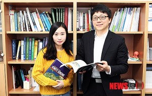
UNIST professor Jungho Im received a research grant in “Development of Space Core Technology” from the National Research Foundation of Korea (NRF Korea) last June.

Central Korea has been suffering from flooding while the southern part is complaining about hot and dry weather for the last couple of weeks. Weather patterns are no longer statistically predictable.

To mitigate this problem, professor Im’s research team is developing a more accurate way to monitor and predict future weather changes.

The UNIST research team “Intelligent Remote Sensing and Geospatial Information Systems (IRIS)” led by Prof. Im, took a big step toward developing technology for monitoring climate change, including drought projection using GIS modeling, and past climate data.

“We started to work on developing technology which is able to predict the present as well as future weather changes based on the modeling data collected from the satellite Chollian, also known as Communication, Ocean and Meteorological Satellite 1 (COM-1),” said Prof. Im.

With this technology, we are able to monitor the progress of the drought in meteorological, agricultural, and hydrological aspects and to set up the strategies and actions against those problems by combining past weather data and the data from monitoring.

Prof. Im started the research on developing the technology last year, and was selected in the Development of Space Core Technology Program last June. “Developing drought monitoring system and its application through Convergence modeling of multi satellite data.”

“Korea still needs to pay much closer attention to drought monitoring, prediction and its control. Research on these issues is not yet focused, but rather it is scattered around,” said Prof. Im. “This research will be a step stone for cultivating experts and constructing infrastructure to utilize the advanced data from the satellites.”

The IRIS research team also focuses on research topics including remote sensing, GIS modeling and artificial intelligence techniques to broaden and deepen our understanding of the Earth systems under climate variability and changes.

“We would like to expand the application of monitoring system based on remote sensing to managing water resource, agriculture, and forest resource and urban planning through this research,” said Prof. Im, showing his research plan. “We can protect human life by managing the information on climate changes of ecosystem, various disasters, water resource, and carbon circulations.”

There are a total 13 of students in the IRIS lab including 6 graduate, 5 undergraduate students and 1 researcher under the guidance of Prof. Im. “I’ve been interested in the area of drought monitoring using satellite data,” said a senior Seon Young Park from the School of Urban and Environmental Engineering. “I am so proud that our research could contribute to the prosperity of human.”

원문: http://www.unist.ac.kr/board/view.sko?boardId=Notice&boardSid=5037&menuCd=AB07002001000&contentsSid=8297&orderBy=register_dt&startPage=1&searchType=&keyword=&searchStartDt=&searchEndDt=&dataSid=2043890

Friday / May 13, 2016

UNIST, 가뭄 모니터링 시스템 개발 ‘착수’

NOTICE/NEWS /

【울산=뉴시스】고은희 기자 = 연일 ‘물폭탄’에 시달리고 있는 중부지방과 달리 남부지방은 폭염과 마른 장마가 이어지고 있어 때 아닌 가뭄을 우려해야 하는 처지에 놓였다. 이에 대한 방안이 마련될 전망이어서 주목된다.

UNIST(총장 조무제·울산과학기술대) 도시환경공학부 임정호 교수가 이끄는 IRIS(Intelligent Remote sensing and geospatial Information Systems)연구실이 최근 위성자료와 과거의 기후 데이터베이스를 이용해 현재와 미래의 가뭄 등 다양한 기후 변화에 따른 대응방안을 마련할 수 있는 기술개발에 착수했다.

임 교수는 “지난 2010년 발사된 ‘천리안 인공위성’을 포함한 다양한 위성자료 모델링을 통해 얻은 가뭄 관련 정보들을 현장관측 자료와 과거의 가뭄 관련 기후변화 데이터베이스와 결합해 분석함으로써 현재는 물론 미래의 가뭄 관련 예측정보를 제공하는 기술 개발에 나선 것”이라고 말했다.

위성자료 모델링을 통해 경기도나 울산 등 특정지역의 가뭄이 기상학적, 농업적, 수문학적 가뭄 등 어떤 형태로 진행되고 있는지를 파악하고 과거 같은 유형의 가뭄 데이터베이스와 결합함으로써 적절한 가뭄 대책을 세우도록 하는 것이다.

수문학적 가뭄은 연못과 저수지 등 물 공급원이 통계적으로 평균 이하로 떨어지는 상태를 말한다.

지난해부터 이 같은 연구를 추진해온 임 교수 연구팀은 지난달 한국연구재단(이사장 이승종)으로부터 우주핵심기술사업과제(다중 위성자료 융합 모델링을 통한 가뭄 모니터링 시스템 개발 및 활용)로 선정돼 연구에 더욱 박차를 가할 수 있게 됐다.

임 교수는 “아직 대한민국은 가뭄 예측이나 감시 등 가뭄 대응에 대한 인식이 부족하고 연구 또한 각 분야에서 산발적으로 수행하는 경향”이라며 “이번 연구가 선진국 수준의 위성자료 활용을 위한 인프라 구축과 관련 인재양성의 큰 계기가 될 것”이라고 말했다.

임 교수가 이끄는 UNIST IRIS연구실은 위성과 항공 원격탐사, GIS(지리정보시스템) 모델링, 인공지능 기술을 활용해 지구상의 다양한 기후 및 환경변화에 대한 연구도 함께 진행하고 있다.

임 교수는 “이 같은 연구를 통해 수자원과 농작물 및 산림자원 관리, 도시계획 등 분야까지 위성을 통한 원격탐사기반 모니터링 시스템을 확대하려는 것”이라며 “이를 통해 육상은 물론 연안이나 극지생태계의 변화와 각종 재난재해, 수자원, 탄소순환과 관련된 주요한 기후변화 정보들을 보다 정확하고 효율적으로 관리함으로써 인류의 생활안전을 보호할 수 있게 될 것”이라고 설명했다.

UNIST IRIS 연구실은 임 교수의 지도아래 6명의 대학원생과 5명의 학부생, 석사급 연구원 1명 등 총 13명이 연구에 전념하고 있다.

연구실의 박선영(24) 학생은 “위성 자료를 이용한 가뭄 모니터링 연구는 평소 관심있었던 분야”라며 “이번 연구가 많은 이들의 삶에 공헌할 수 있다는 사실에 뿌듯하다”고 말했다.

gogo@newsis.com
기사 원문: http://www.newsis.com/ar_detail/view.html?ar_id=NISX20130801_0012262701&cID=10814&pID=10800